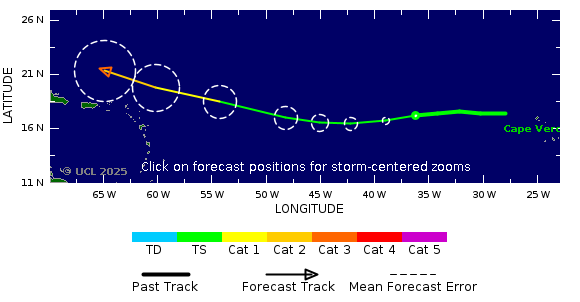
TSR’s award-winning Storm Tracker is a free, easy-to-use tool for monitoring active tropical cyclones across the globe. Updated every 3 - 12 hours, it provides live storm positions and projected paths using data from the National Hurricane Center (NHC) and Joint Typhoon Warning Center (JTWC). Storm tracks and intensities are colour-coded according to the Saffir–Simpson wind scale, making it easy to assess potential severity at a glance. TSR’s Storm Tracker includes probabilistic wind swathes, allowing users to understand the likelihood of a location being hit by damaging winds. Users can see the chance of Tropical Storm strength winds (39+ mph) and Category 1+ winds (74+ mph) affecting an area, across time intervals of 0, 12, 24, 36, 48, 72, 96, and 120 hours). Point zooms allow users to examine the error margin of the projected storm position, factoring in variance.
Whether for business continuity, emergency planning, or public awareness, TSR’s Storm Tracker helps users understand the likelihood of impact to people, infrastructure, and assets, enabling faster, more informed decisions.
| Time | Position | Strength | Wind Probabilities | Wind Model | ||||
|---|---|---|---|---|---|---|---|---|
| GMT | Lead | Lat | Long | Peak Wind | Cat | TS | Cat 1 or Above | Wind Field |
| 22 Aug, 21:00 | 0 hrs | 40.0 N | 59.7 W | 80 kts | 1 | Click Here | Click Here | N/A |
| Time | Position | Strength | Wind Probabilities | Wind Model | ||||
|---|---|---|---|---|---|---|---|---|
| GMT | Lead | Lat | Long | Peak Wind | Cat | TS | Cat 1 or Above | Wind Field |
| 23 Aug, 6:00 | 9 hrs | 41.5 N | 54.5 W | 80 kts | 1 | To 9 hrs | To 9 hrs | Click Here |
| 23 Aug, 18:00 | 21 hrs | 44.0 N | 45.5 W | 75 kts | 1 | To 21 hrs | To 21 hrs | Click Here |
| 24 Aug, 6:00 | 33 hrs | 48.0 N | 35.5 W | 75 kts | 1 | To 33 hrs | To 33 hrs | Click Here |
| 24 Aug, 18:00 | 45 hrs | 52.0 N | 27.0 W | 85 kts | 2 | To 45 hrs | To 45 hrs | Click Here |
| 25 Aug, 18:00 | 69 hrs | 58.0 N | 21.0 W | 55 kts | TS | To 69 hrs | To 69 hrs | Click Here |
| 26 Aug, 18:00 | 93 hrs | 59.0 N | 21.0 W | 45 kts | TS | To 93 hrs | To 93 hrs | N/A |
| 27 Aug, 18:00 | 117 hrs | 57.0 N | 17.5 W | 40 kts | TS | To 117 hrs | To 117 hrs | N/A |
| Current Update | 22 Aug, 2025 21:00 | Prior Wind Affected Areas | TS and Cat 1 Winds |
|---|
|
|
||||||||||||||||||||||||||||||||||||||||||||||||||||||||||||||||||||||||||||||
*Note that the windspeed scale used here is the Saffir-Simpson hurricane wind scale. This differs from wind scales used by regional agencies other than the National Hurricane Center. The category applied to a storm on this site may differ from the category applied by an official regional meteorological agency.
|
|
Researched and Developed by
Mark Saunders,
Frank Roberts
and
Adam Lea TSR Version 4.1 Copyright © 2025 EuroTempest , London, UK Last updated on 22 Aug, 2025 20:49 GMT 
|
|