TSR’s geospatial products deliver detailed, high-resolution data on both live and historical tropical cyclones. Built for seamless integration with GIS platforms and risk modelling tools, these 5 km resolution datasets enable precise analysis and informed decision-making. Offered via commercial subscription in multiple file formats, with API access for automated delivery, TSR’s data supports insurers, emergency planners, and analysts in anticipating and responding to tropical storm risks with greater confidence.
 |
TSR’s post-event footprints provide maps of the actual wind and gust intensities experienced during a tropical cyclone. Produced after each advisory, these datasets offer a reliable view of the storm’s historical wind extent, which is essential for verifying forecasts, estimating losses, and supporting insurance claims. Wind footprints are available in regional wind scales, while gust footprints reflect the peak damaging wind speeds recorded. These datasets are critical for insurers, modellers, and recovery teams who need the full depiction of recorded wind speeds to make decisions. |
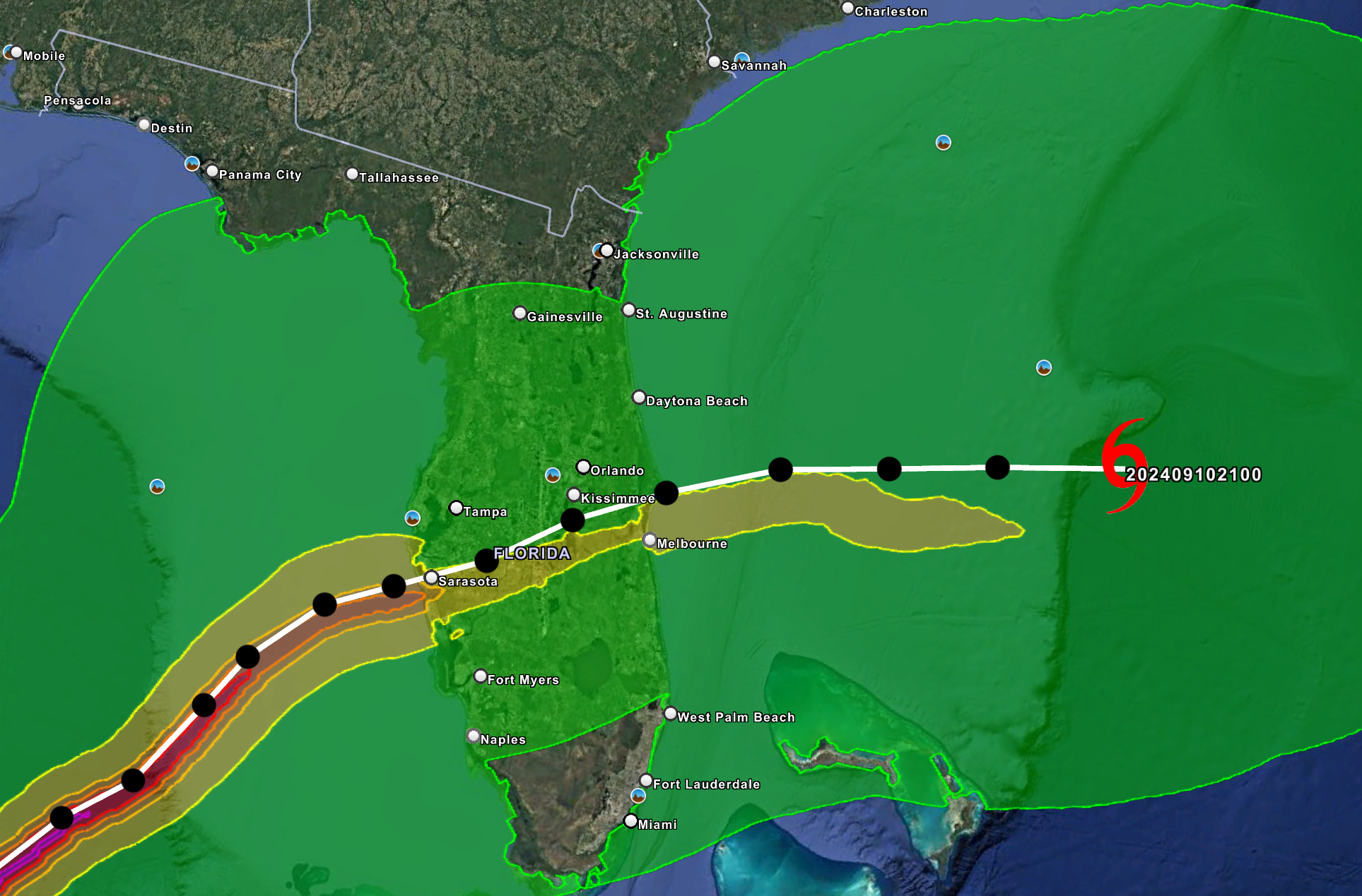
| TSR provides maps of the projected track and intensity of tropical cyclones, including the most likely (deterministic) wind and gust footprints up to 120 hours in advance. Updated every 3–6 hours, these forecasts are available in regional wind scales, and gust speed bands ranging from 40 mph to 200 mph. | 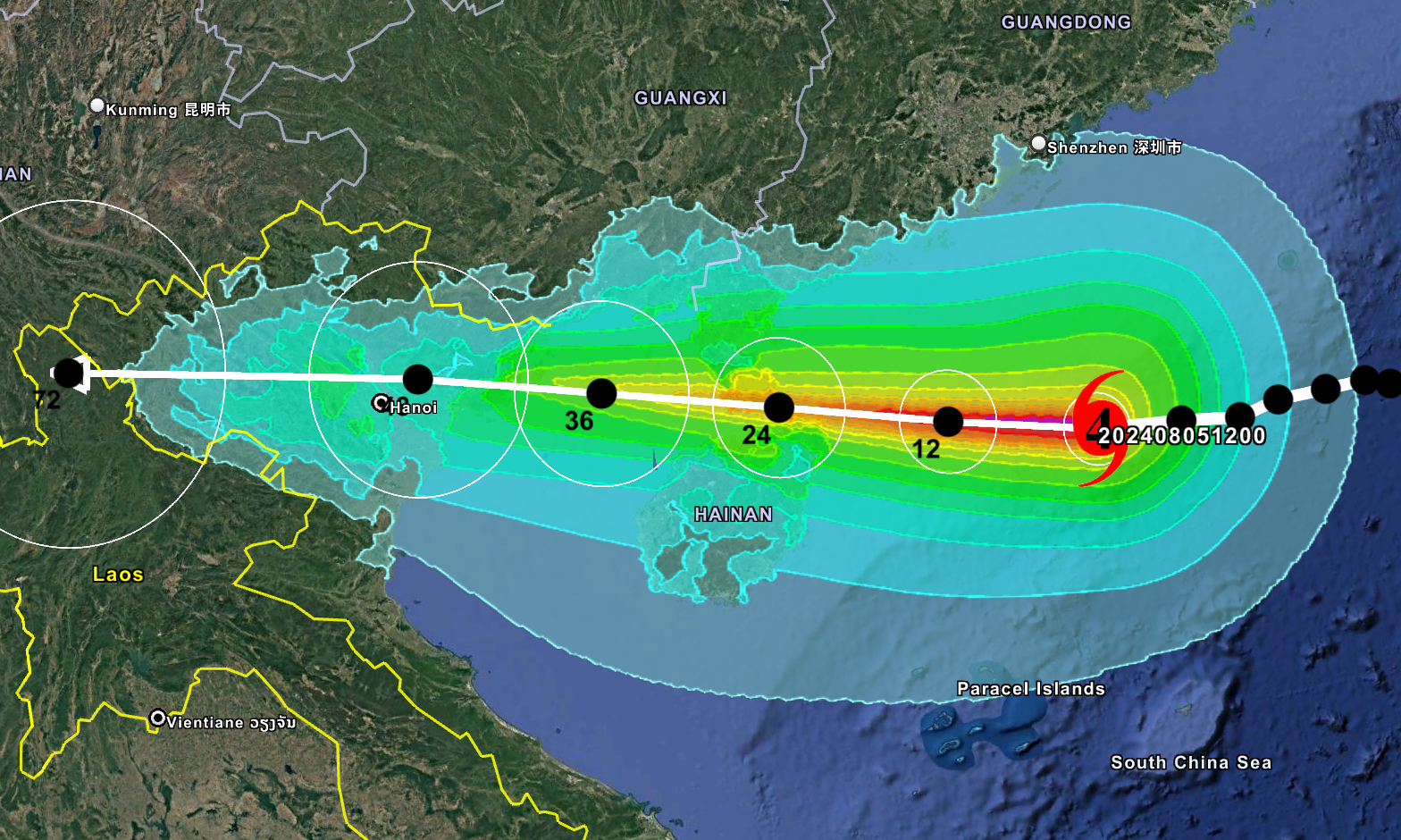 |
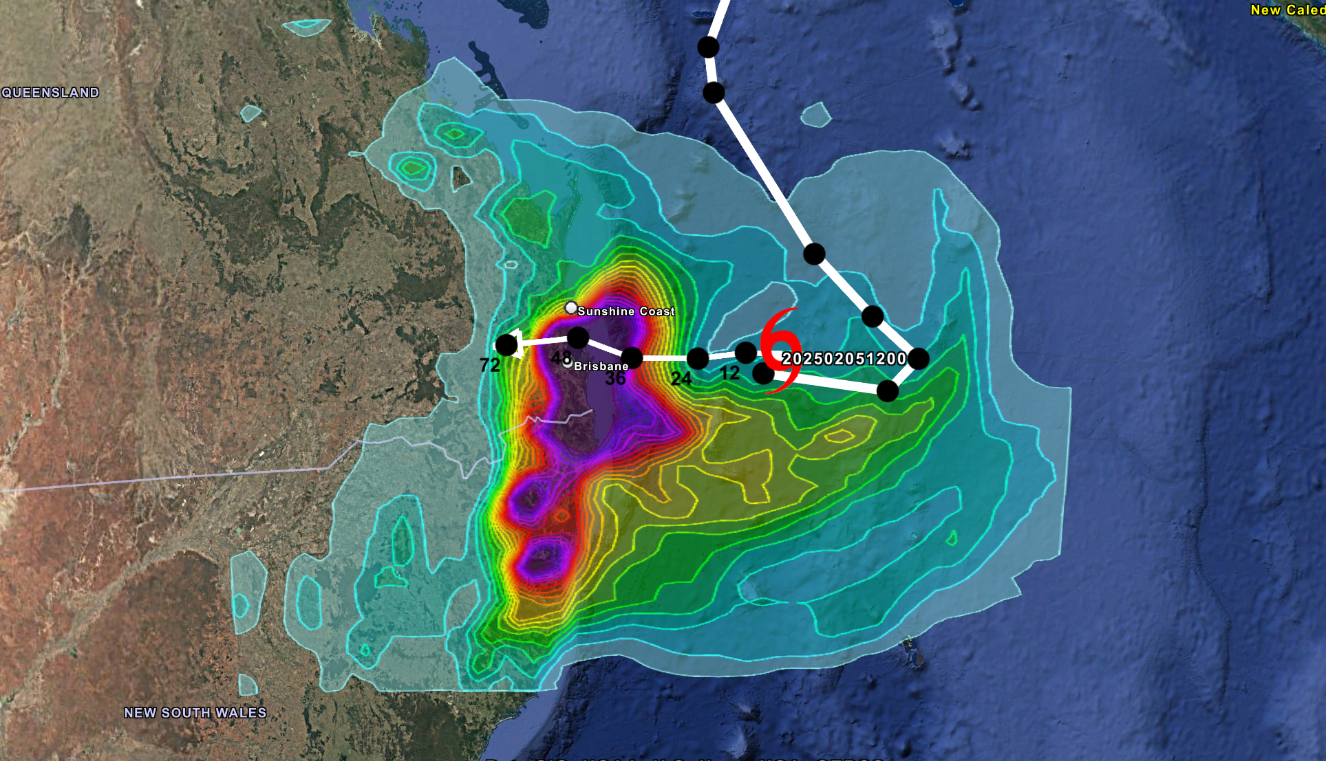 |
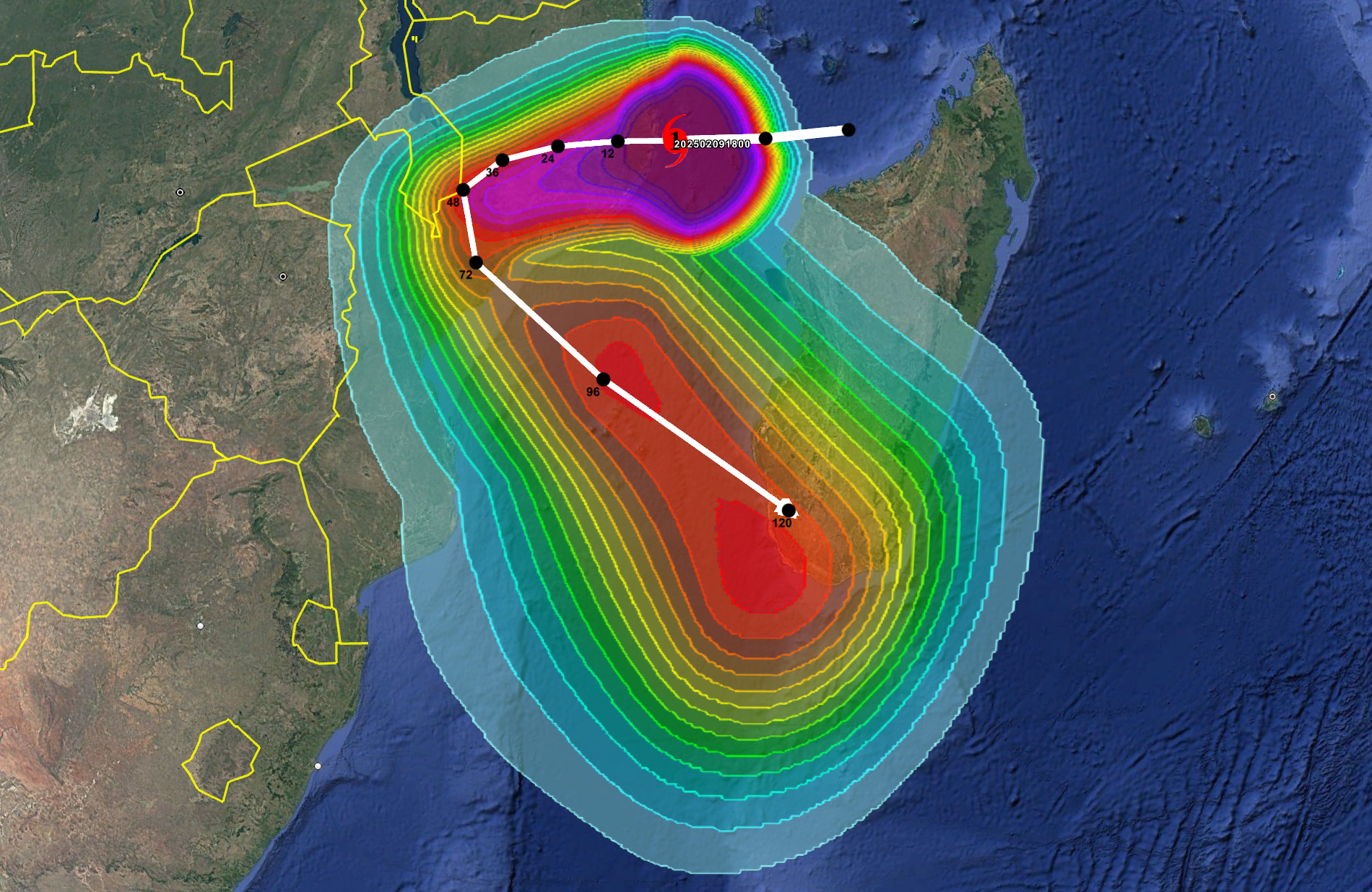
Rainfall associated with tropical cyclones can often have more devastating consequences compared to the damage from high winds. Our rainfall footprints show the past and forecast storm track from regional advisories, overlayed with rainfall accumulations over 12, 24, 36, 48, 72, 96, and 120-hour intervals so users can highlight areas at risk of floods, landslides, or mudslides. Data updates every 3-6 hours. |
| TSR’s Ensemble Forecast product simulates 100 equally-likely tropical cyclone scenarios with every advisory, using authoritative data from the National Hurricane Center (NHC) and Joint Typhoon Warning Center (JTWC). These forecasts show a wide range of possible storm tracks and intensities over the next 120 hours, offering a deeper understanding of uncertainty in forecasted impacts. Each member opens as a wind or gust footprint at 5 km resolution, capturing variability in both sustained winds and damaging gusts. Ideal for catastrophe modellers, risk managers, and insurers, this product supports impact-based planning, strengthens contingency strategies, and enables more informed decision-making. | 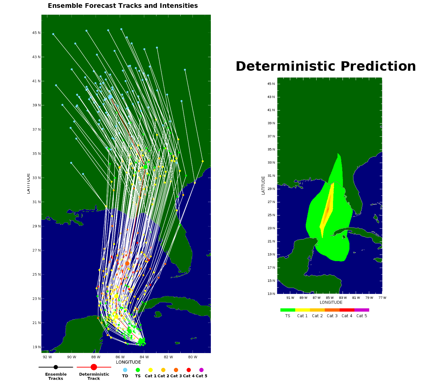 |
 |
TSR provides probabilistic forecasts showing the likelihood of Tropical Storm-force winds (39+ mph) and hurricane-force winds (74+ mph) over the region. Probabilities are calculated at multiple lead times: 0, 12, 36, 48, 72, 96, and 120 hours, offering a dynamic view of risk as a storm evolves. Unlike deterministic forecasts, which show a single projected outcome, this dataset captures uncertainty and enables users to evaluate the probability of damaging winds across a region. Insurers and reinsurers can assess potential portfolio exposure in real time, while humanitarian agencies gain early insight into areas likely to need aid and support. |
Tropical storm footprints are available from 2008 onwards and can be downloaded by subscription, based on your selected products and oceanic basins.
Learn more about TSR's products.
Learn more about our Regional Advisory data.
TSR's subscription service to tropical storm footprints.
To enquire about TSR's subscription service or to request a free trial, please contact TSRenquiries@tropicalstormrisk.com.