Tropical Storm Risk (TSR)
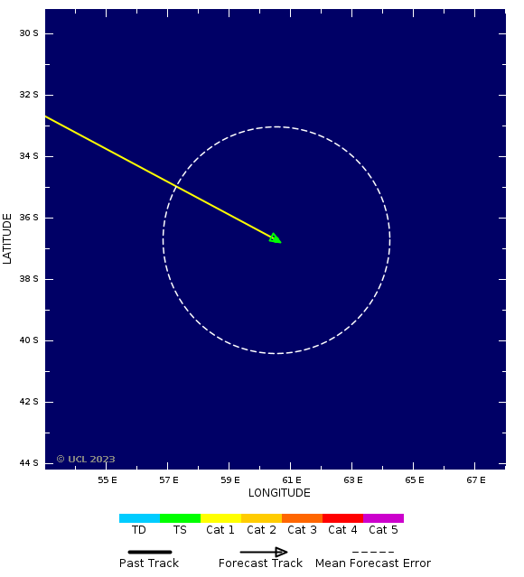
Tropical Cyclone CHENESO: Storm-centered zoom at 120 hours lead
|
|
| Tropical Cyclone Windspeed Scale |
|---|
| Strength | Category | 1 Minute Maximum Sustained Winds |
|---|
| knots | mph | km/h |
|---|
| Tropical Depression | TD | <34 | <39 | <63 |
| Tropical Storm | TS | 34-63 | 39-73 | 63-118 |
|
Tropical Cyclone
| Cat 1 | 64-82 | 74-95 | 119-153 |
|
Tropical Cyclone
| Cat 2 | 83-95 | 96-110 | 154-177 |
|
Intense Tropical Cyclone
| Cat 3 | 96-112 | 111-129 | 178-208 |
|
Very Intense TC
| Cat 4 | 113-136 | 130-156 | 209-251 |
|
Very Intense TC
| Cat 5 | >136 | >156 | >251 |
|

|
Researched and Developed by
Mark Saunders,
Frank Roberts
and
Adam Lea
TSR Version 4.1 Copyright © 2023
UCL
University College London,
UK
Last updated on
26 Jan, 2023 2:07 GMT

|

|